Generating Thiessen Polygons
A Thiessen polygon is a Voronoi Diagram that is also referred to as the Dirichlet Tessellation. Given a set of points, it defines a region around each point. A Thiessen polygon divides a plane such that each point is enclosed within a polygon and assigns the area to a point in the point set. Any location within a particular Thiessen polygon is nearer to that polygon’s point than to any other point. Mathematically, a Thiessen is constructed by intersecting perpendicular bisector lines between all points.
Thiessen polygon has many applications in different location-related disciplines such as business planning, community services, transportation and hydraulic/hydrological modeling. For water distribution modeling, the Thiessen Polygon Creator was developed to quickly and easily define the service areas of demand nodes. Since each customer within a Thiessen polygon for a junction is nearer to that node than any others, it is assumed that the customers within a particular Thiessen polygon are supplied by the same demand node.
The following diagrams illustrate how Thiessen polygons would be generated manually. The Thiessen Polygon Creator does not use this method, although the results produced by the generator are consistent with those that would be obtained using this method.
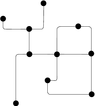
The first diagram shows a pipe and junction network.
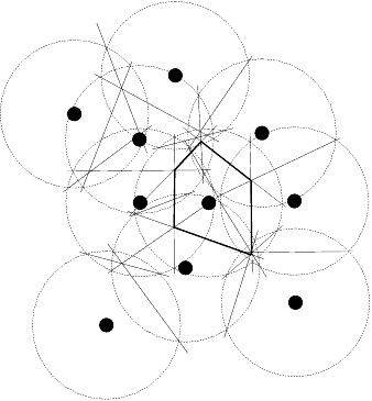
In the second diagram, the circles are drawn around each junction.

In the third diagram, bisector lines are added by drawing a line where the circles interjoin.
In the final diagram, the network is overlaid with the polygons that are created by connecting the bisector lines.
